Pages

Thursday 20 April 2017

Wasdale Head to Scafell in Pictures

The number of people hiking up Scafell Pike every summer would probably fill a football stadium but the neighboring peak of Scafell - though an equally fine expedition when the rain stays away - is far less frequented. England's second highest peak is definitely the abode of the fellwalker rather than that of the tourist. The route initially follows the same path (from Wasdale Head village green or the National Trust campsite - the paths converge shortly after where the first two photos were taken - initially following the stream of Lingmell Gill and then up the relentless slopes to Hollowstones - the wild and rock cwm below the peaks. The way to the Pike - and the crowds - branch off to the left while our route continues up over rough steep terrain to Mickledore the obvious col between Scafell and Scafell Pike at about 2650ft.. 

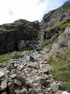
Head down the far side for a short way towards Upper Eskdale, keeping to the right which avoids a boulder field, until the gully is spotted leading up through broken crags to the right. Going up here can be wet after rain as it doubles as a stream bed but it's not boggy and we stayed dry today!  The path is clear up past Foxes Tarn - which turns out to be a small pool with a rock in the middle - and on up to the summit of Scafell which at 3162ft is the second highest point in England.

If anything this route is harder than the slightly higher Pike due to the roughness of the terrain and the descent from Mickledore. The rock scenery up to the ridge is sublime and the ascent of the Foxes Tarn gully exciting but not difficult or exposed. We descended west from the summit via the Green How route which is without difficulty unless you follow our route down the steep scree back to Lingmell Gill - better to continue on down to Brackenclose and the campsite. 

Total distance 10km/6.25 miles >>> Ascent 3100ft/950m >>> Descent 3100ft/950m

The Lord's Rake route was subject to rock falls some years back and has a large boulder to be negotiated. It's passable but there's always a risk of further rock falls and this route is a straightforward one. Do not be tempted to go up Broad Stand - the direct route from Mickledore unless you're an experienced rock climber - it looks short but it's a climb rather than a walk and without a belay rope a slip would not end well!

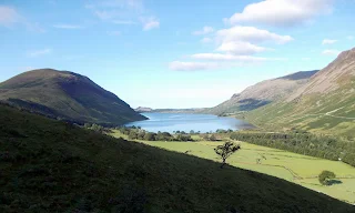
wastwater in the lake district
Wastwater and the Screes from early in the walk

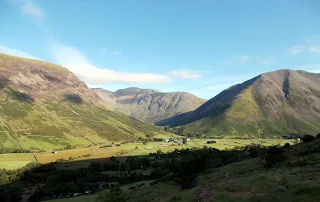
wasdale head from path to scafell
Wasdale Head from the same place looking to Pillar and Kirkfell

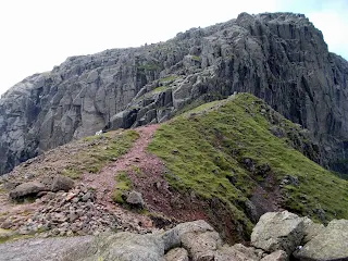
route to mickledore and scafell
Further up is the area known as Hollow Stones just below Mickledore

mickledore between wasdale and upper eskdale
Mickledore separates Scafell and the Pike looking to Broad Stand

hiking scafell from wasdale head
Looking up the gully towards Foxes Tarn

Looking back down the gully from just before the tarn

summit view from scafell
The summit of Scafell with the Wasdale Fells and Grasmoor far distance

Scafell Crag with Deep Ghyll Butress left and Scafell Pinnacle

The Wasdale Fells looking towards Pillar, Kirkfell and Mosedale

Looking back to Scafell Pike 

The top of Deep Ghyll Butress is a fine vantage point reached by an easy scramble

Wednesday 7 October 2015

A Short Walk in the Western Fells

Only the seasoned Wainwright bagger and local residents of West Cumbria will ever have heard of the hill called Grike but for everyone else it's the westernmost of the Wainwrights or Lake District
western lakes
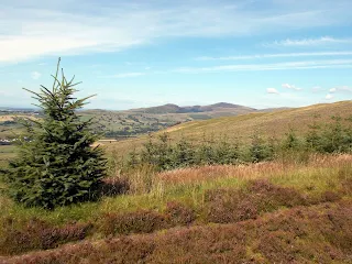
The early part of the walk looking to Blake Fell
Fells, and stands next to Crag Fell whose far side rises splendidly above Ennerdale Water. In the mist and rain this area is bleak and lonely indeed but when the sun shines it reveals a side of the Lake District most tourists never see. Lonely it certainly is but that is part of its appeal.

Leaving the minor road that links Gosforth and Ennerdale Bridge I followed the track that leads into the hills from just south of Kinniside Stone Circle. The ancient monument itself is well worth a visit before setting out and if you're not walking is a worthwhile destination in itself. The track led over open fields before reaching patchy coniferous forest beyond a gate and climbing at an
easy gradient to meet another track coming up from woodland below. Crossing this trail, the open fellside was gained close to a low col and I took the left hand of two tracks in a roughly easterly direction over open grassland. After a short distance - perhaps a kilometre or so - I left the trail and crossed a stile to climb the sheep cropped turf to the left up to the large cairn on the summit of Grike.

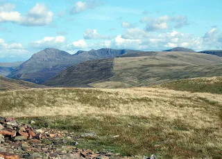
At 488m this is no great height but its position as the westernmost of the Wainwrights affords a wide view over the West Cumbrian Plain and the Irish Sea as well as ahead where the grassland rises steadily towards the more rugged terrain of Pillar, Scoat Fell and Haycock on the horizon. Leaving the cairn I headed on down into the dip between here and Crag Fell which is slightly higher at 523m. The low ground is boggy and it's maybe better to
western lake district fells
Pillar Scoat Fell and Haycock from the summit of Grike
return to the track which lies just beyond the communications mast right of the dip but I didn't and got slightly wet.

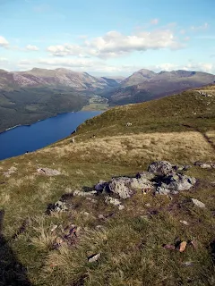
The top of Crag Fell is impressive for a lesser fell and commands an eye catching panorama of the head of Ennerdale above a steep drop to Ennerdale Water. It is well worth journeying the short distance beyond the cairn to the next minor summit where the view is even better and brought to mind the walk along the top of the Screes from Whin Rigg to Illgill Head above nearby Wastwater.

These lower hills often provide an experience in excess of their stature and these two remote and
Ennerdale Water
The wild head of Ennerdale from Crag Fell
seldom visited summits are no exception though today the weather contributed to the experience with blue skies and far off views forming a backdrop to the empty miles of Lakeland's western rim. What had started as a mere peak bagging exercise to achieve two more ticks towards finishing the Wainwrights became a fine walk in itself.To return I merely headed south from Crag Fell to join the original track further up and follow it back to where I had started for a total outing of just under 9km or 6 miles.